Omer has been visiting with me for the past couple of weeks. We decided to go on a trip and were debating the location until about 2 days before we left. We finally decided on Baja California, the western-most part of Mexico.
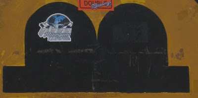
But First a Puzzle
Can you tell what this is?
Anyway, airline tickets were fairly trivial, with miles covering the trip and dollars covering the airline's ticket cost. Really. I'm not sure what the miles were for.
Obtaining a rental car was more difficult. The phone call went something like this:
Eran: Hi - do you rent cars from San Diego that can be driven south into Baja?
Company 1 rep (C1): Yes.
Eran: Can they drive all the way south into Baja.
C1: You can go as far as 250M south of the border.
Eran: Is that enough to go south all the way?
C1: I'm not sure. I'm not at that location.
Eran: I'm not at that location either.
A pregnant pause begets crickets that go on to sing imaginary songs until I give up and go check in google maps. 250 miles won't cover it.
Company 2 (they DO try harder) let me drive all the way south to the North 28 parallel line. The agent promised me that covers Baja. It doesn't.
Cars and the Mexican way
The Mexican border is one of the strangest ones I've ever seen. You drive south on highway 5, then there's sign that you're approaching the border, then you're on the other side. You don't even stop. No passports, no checks, nada.
Then start the more exotic views. First thing coming out of the border crossing and driving south, you see a large Costco. Quickly after that are many other North American chains. We left Tijuana quickly.
Overcompensating I
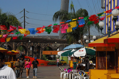
Our first stop was in Ensenada, some 100 miles south of the border. The town is a fishing and tourist town with a nice waterfront and shopping area. Cruise ships do day stops there and the tourist walk up and down the area. Once the ship leaves though, the stores close down. It was a Saturday, so the locals also went out at night and we had a nice evening people watching.
Before we left for the trip, my dad asked where we'll sleep. I asked him the riddle about where an 8 ton elephant sleeps. (anywhere it wants). We had no problem finding lodgings throughout this trip.
Walking around we noticed a huge flag of Mexico waving over the town. To get a feel for the size, see if you can find Omer in this picture:
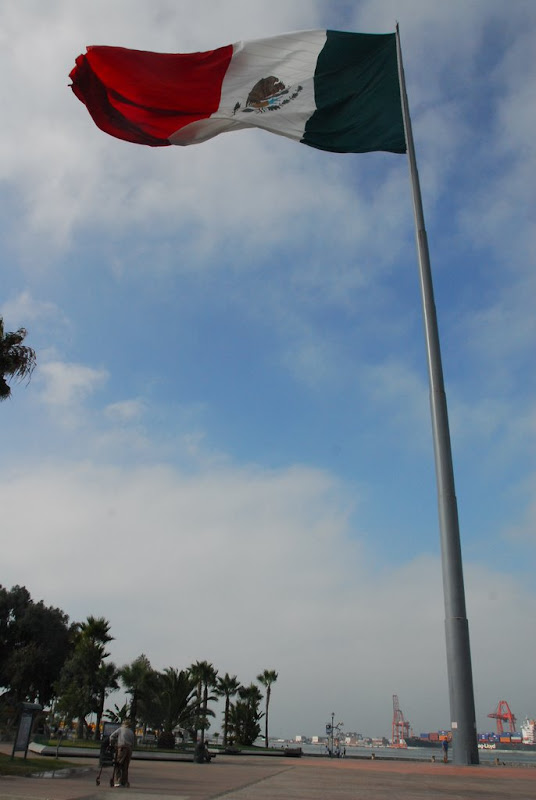
Ok. Here's a hint:

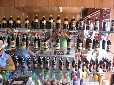
The other reason people travel to Mexico (other than tourism) is for cheap prescription medicine (unhealthy, sometime imitation). Pharmacies are as prevalent as tourist gift shops. One had a list of all special medicine available in it, including this picture to help everyone understand:

Other than that, pharmacies also sold Vanilla extract. We're not quite sure what the deal is. I can't see a tourist going in and saying: "Give me 10 packs of Cialis, 2 Viagra, some muscle relaxers. And throw in some Vanilla. For the kids, you know."
Overcompensating II
The following day we continued south. Our original goal was a town called Guerrero Negro, halfway down the peninsula. We quickly realized that we won't get there in one day. In fact, the maximum legal speed when outside towns was around 80km. The roads are good, but have one lane only and turn through the mountains, limiting the speed with which you can travel.
The first half of that day was a bit of mountains and a lot of Mexican small town scenery. If you've ever seen Fresno, downgrade a bit and you'll know what to expect. The only difference is that with the exception of bigger towns, villages are mostly stretched out along the road itself.
At some point we decided to give up, stop a couple of hundred of km south, then drive up through a parallel road on the other side of the peninsula, that would lead us to a fishing village. We didn't quite make it that first day - we reached the road, but it was late and the "road" (marked on the map as an interstate highway, "graded dirt road") didn't seem easy to travel at night.
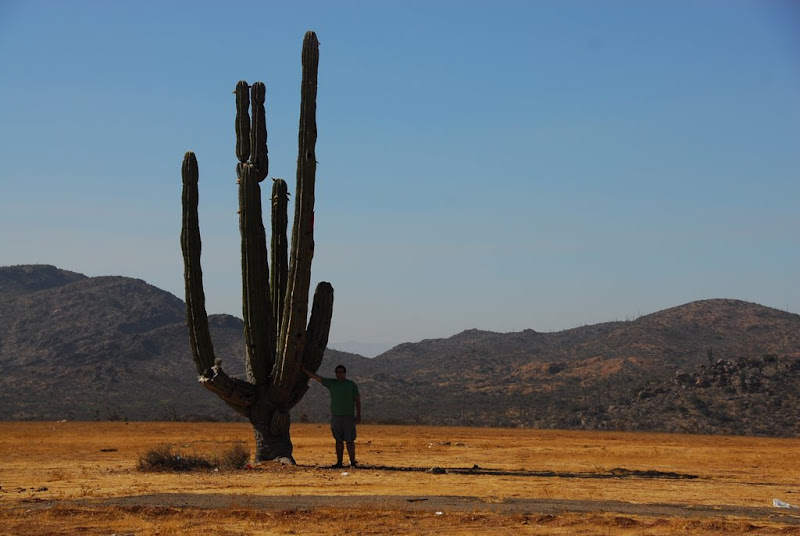
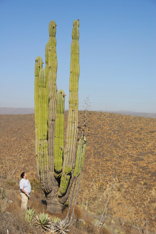
Instead we traveled down to Bahia de Los Angeles (Angels Bay) on the sea of Cortez. Somewhere midway, the scenery changed completely. We left the urban area and climbed up to the valley of the Cirios (also known as Boojum trees). The valley stretches a big part of the Baja peninsula and is filled with Cacti of every kind. What impressed us was the shape, and the sheer size of some of these:
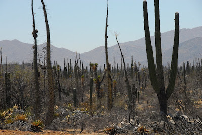
(The Cirio is the tree on the left)
These are the Cardons:
I'm Popeye the Sailor Man
The next morning we took a boat ride on the sea of Cortez. The sea is the body of water between Baja California and mainland Mexico. There are lots of islands in the area and other than fishing, there are sharks and whales to see.
Our guide and boat driver, Martin, did not speak a word of English, but could easily wave at the things we should look at.
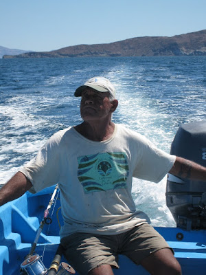
(notice his tattoo - all that's missing is the pipe!)
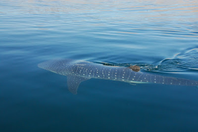
First thing, he found us a baby Whale Shark to look at. It was about 2-3m long (6-9 feet) and was leisurely swimming a few feet away from the boat.
The road to Coco's Corner
We then went back on the road driving north this time, looking for that split in the road that would take us to the fishing village, San Felipe. The split is near a town called Chapala. We saw the sign, but had to turn around a couple of times until we realized that yes - those two buildings (1 a restaurant, 1 a store) WERE Chapala.
We took the dirt road and started driving. It quickly became clear that the car, a sedan, was not really suited to this. We drove slowly, aiming for a stop at Coco's corner, another marker on the map and the only one between us and a village on the coast.
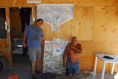
Here's Coco's corner:
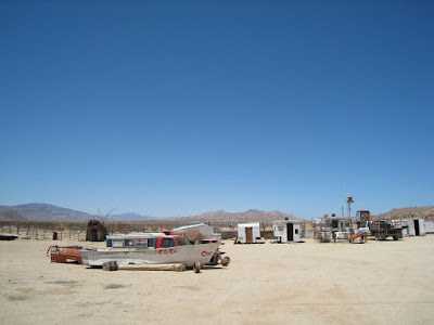
Coco's corner is a cleared area 100m (300ft) on the side, surrounded by beer-can-strung wires and a few vehicles. The main shed held a raised car that looked like it was being worked on. We stopped and looked around, then suddenly Coco emerged from behind the car.
Apparently he's living there by himself for quite a while. People stop by and he sells them soda or beer, talks with them and sends them on their way. Coco's shed is decorated with underwear and shirts of previous visitors...
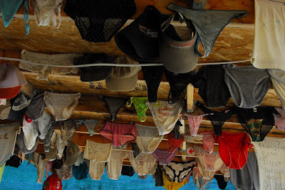
... as well as a huge pair sent by some devoted fan.
Coco was very clear that we're unlikely to make the road to San Felipe with our car. It would take luck, and if the transmission broke, there's no one to come bail us out. It didn't take much convincing to turn us around.
Back to Ensenada
And so, tail between our proverbial legs, we turned back to the main road to drive north to Ensenada. The drive itself was no less fascinating, with Cirios and Cardons and other plants surrounding us. At a certain point, we had to slow down quickly to avoid turning a road runner into road kill. It slowly walked across the road, looking at us the whole time.
Had we been Wiley E. Coyote, I don't think it would have survived.
Radio reception throughout these two days was patchy to non-existent. The radio's scan feature would run around and around for an hour at a time, finally stopping on a channel it could catch as we crested a hill. A few feet later, static would once more be our companion. In fact, most times we'd suddenly find a channel just as the commercials were going on. As the song started, the channel would fade away. Even mountain ranges shape themselves to market forces. Capitalism rules!
Getting closer to Ensenada, we were able to get more and more radio. Most channels were from California, but some were in Spanish. At a certain point Britney and a Spanish-speaking singer were competing for airtime during "Circus".
The Unknown Celebrity
After a night in Ensenada, we set our sights on Tijuana's famous nightlife. We arrived before noon, found a place for two elephants to sleep, then went to tour the main strip, Calle Revolucion. There are many stores catering to tourists, selling statues, trinkets, food, etc. There were also a number of Mexican Zebras, a variant of the common white Donkey that were painted with black stripes then put to stand on street corners to take pictures with tourists.
But there were no tourists.
Apparently while this is the tourist season, the place is only alive and rocking on the weekends when many people cross the border to come visit Tijuana. During the week, the place is deserted.
We stopped for lunch at an empty restaurant / pub / club. As we were going to our 2nd floor table overlooking the main strip, a good looking couple sitting at a nearby table nervously eyed me and my camera. Even though the lens cover was on and the camera was on the chair the entire time we were there, the couple kept sneaking glances our way. We're not sure who needs to be more embarrassed: us for not recognizing either of them, or them for expecting to be recognized.
Really Northern Baja California
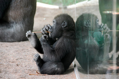
It's a little known fact that if you drive north in Tijuana, all the way towards the US, you'll eventually reach a zoo. A large zoo. One of the nicest in the world. We spent our last day in San Diego at the zoo, touring the surprisingly lively gas light district and going to the beach on a cloudy day with freezing water. We did see dolphins though...
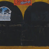
Puzzle Solution
The picture at the top is cropped from the following:
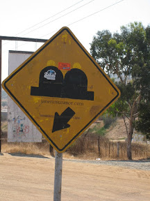
It marks road bumps. There was only one bump. Very disappointing, I know.
The rest of the album can be viewed at:
 |
| Mexico-Aug09 |
Technorati Tags: Baja California, Omer Davidov, Tijuana, Mexico, Ensenada, Bahia de Los Angeles, Cirios, Cardon, Road Runner