Omer (my brother), Mom, and Dad who researched the area, planned the trip, has the itinerary broken down by each hour of each day.
Also featuring:
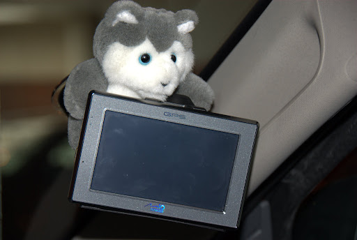
- Samantha - the official name of the voice my GPS uses. Samantha 1.0.3 to be exact.
- Pepper - the trip mascot. We "found" him (we're pretty sure he's a "he") in the store of a gas station chain called Husky. His name came from a misunderstanding about which spray we should use in case wild predators attacked us - paper spray or pepper spray. We finally settled on pepper.
The Mountains
This trip will take us around the Canadian Rockies, a region on the border between Alberta and British Columbia in western Canada. The area is littered with national parks and we will be visiting a large number of them. To start with, we landed in Calgary, took our rental (a Jeep Patriot since our reserved Jeep Grand Cherokee was already given to someone else) and drove in a roundabout way to our first stop, the city of Canmore.
The road we took started out through the plains, with fields filled with hay packets and cow herds grazing nonchalantly. About 20km before Canmore, we took a 150km detour to go through a more scenic route through the mountains.
The road is amazing. At this time of year the weather is fickle. For the first day we had mostly clouds and rain, though the rain did stop towards the second part of our trip and we drove through amazing valleys with mountains surrounding us.
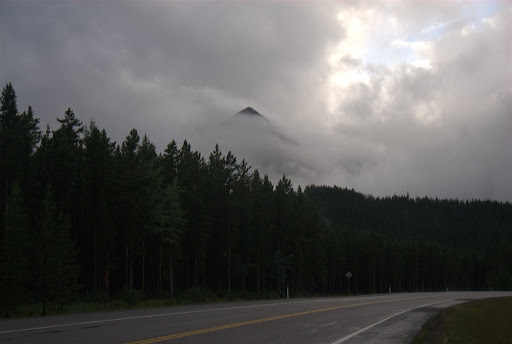
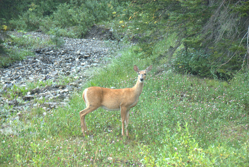
As we drove through we also got to know the car better. A tight SUV, it certainly wasn't the one we wanted. As the road continued and we got off the asphalt road the sun came out, we saw a large river following our course and we even got a glimpse of the local wild life.
Doing It Right The Second Time
We started our second day by driving back to Calgary to get a better car. Now that we had the Grand Cherokee, the trip could start in ernest.
We started by driving through Yoho national park. Our first stop was the Spiral Tunnels, a set of train tunnels throught the mountains that solved the problem of how to get the train through the steep elevation. The tracks used to have a slope of over 4 degrees, which made it very difficult for trains to climb them and hazardous for them to drive down. The longer trains' locomotive used to be 5 meters below the last car, pushing on the train and making it almost impossible to stop.
An engineer solved the problem by cutting two spiral tunnels through the mountains. The tunnels go into the mountain, make a whole circle then exit above the point where they started. This let the trains take the trip with a lower 2 degree elevation and much less risk.
The mountains here are completely covered in pine trees (lodgepole pine to be exact). It looks like someone took lots of green matches and stuck them standing up on the mountain. While the view is beautiful, this setup has the unfortunate side effect of hiding any train tracks or special spiral tunnels. We could clearly see one point where a tunnel starts and could kind of make out a point where a tunnel might be exiting the mountain but no train ran through so we weren't really sure.
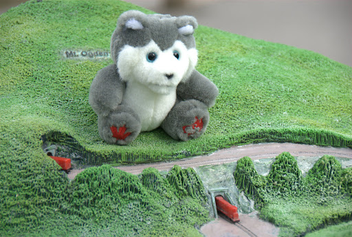
Instead, here's Pepper modeling what the spiral tunnels look like on the mountain.
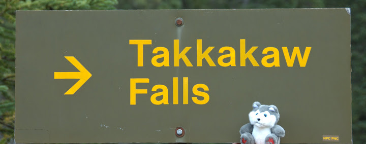
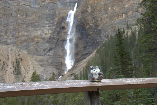
Our next stop was Takakaw Falls. Notice the Indian names that most of these creeks, valleys and falls have. A lot of them are in some local language or are the name of the trive. Takakaw means "beautiful fall" or something like it in the Cree language.
We had a very late lunch in a town called Field. It's in the middle of Yoho park, has a few houses, one restaurant and one hotel. While I don't know the history for the name, I can easily imagine how originally this used to be an open field were some Canadian railway employees used to set up tents or cabins. And the town grew and grew (alright - grew very slowly) but the field stayed "the field" until someone finally officially registered it as such.
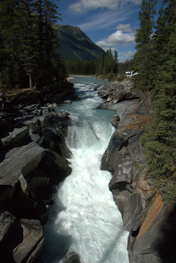
We stopped at this wonderful natural stone bridge where the water cut a channel underneath.
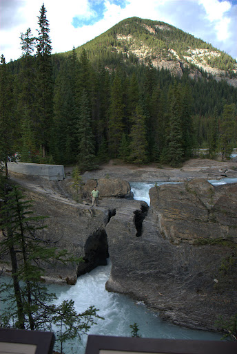
(that's me in the picture, for size reference; and yes - pepper is also in the picture if you look real hard)
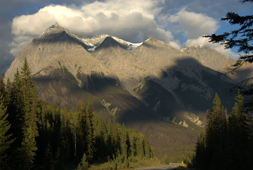
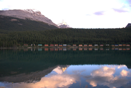
On the way to the hotel, we caught the sun as it was going down, angled over the valley and completely lighting up this mountain range.
And here's one of the slow freight trains across the lake from us:
The Adventures of Heckleberry Rafi and Omer Sawyer
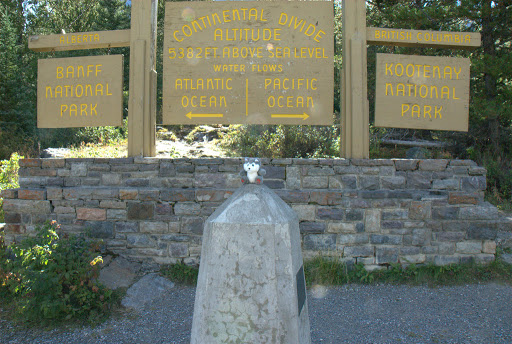
On our third day we visited Kootenay national park. The park has everything from snow-capped peaks at the end of summer to (allegedly) cacti growing in it. We never saw the cacti but the mountain ranges we drove along were awe-inspiring. The border between parks Kootenay and Banff divides a few other things: it's the border between British Columbia and Alberta and also marks the continental divide between the Pacific and Atlantic oceans. Water falling on opposing sides of the marker will flow down to different oceans.
There are some more interesting waterfalls, including this one that cut quite a channel into the ground.
And some very nice viewpoints where you can see a huge part of the valley spread out before you.
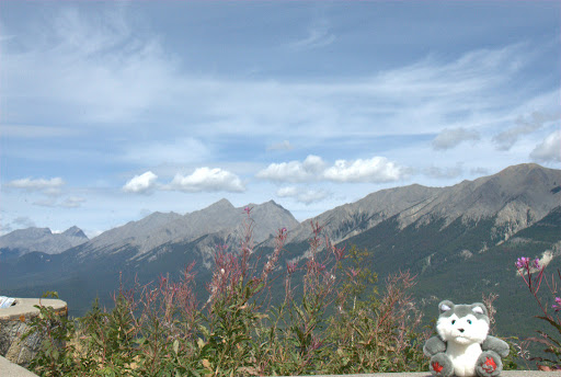
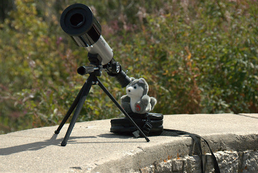
We also tried out our new wildlife-telescope. We mostly managed to see trees really up close.
At the end of the park is the township of Radium Hot Springs named after the, you guessed it, hot springs in the park. From there, instead of retracing our steps, we took a detour around the park. The tourist information center at Radium gave us only a fishing map of the area. The map focused on two main features:
- Rough sketches of the roads we can take. The word "roads" in this context means anything from a highway to an unpaved path cows walk on.
- Lakes. Hopefully with fish in them.
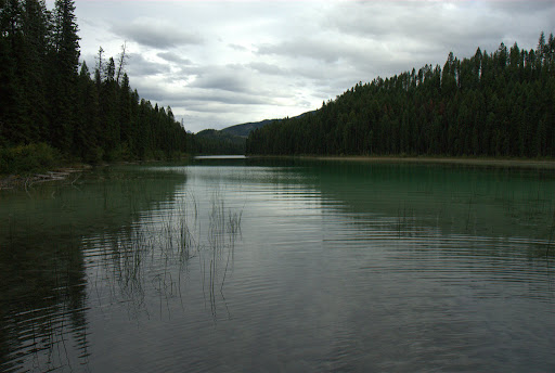
We decided to try finding one of these lakes and so took ourselves off the beaten path and onto the, well, literally beaten pathway along the trees and wild vegetation of British Columbia. After half an hour of traversing dirt roads, past all farms and human habitation, we found Lake Cleland. The water looked blue and beautiful through the trees but there was one problem: there was already one car there. Way too crowded. We decided to go on to lake Jade, a few minutes down that same path.
To explain to you how secluded the lake is, when we stopped the car some 100 meters from the lake a squirrel on a nearby tree chirped menacingly at us for a few minutes. The lake was indeed Jade in color...
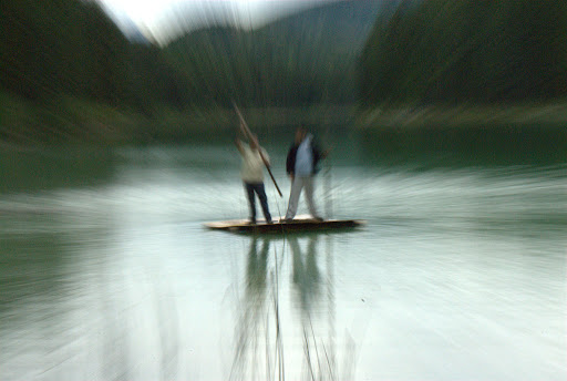
... and true to its fishing-lake nature had a small jetty leading out a few meters onto the water and lo-and-behold, a small hand-made raft someone left from a previous trip. Dad immediately jumped on it to test its strength, then Omer joined him and each with a stick started pushing into the lake.
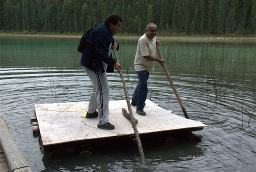
Once the confusion about not pushing in different directions was cleared up, they managed to free the raft from the mud and float it into the middle of the lake. Mom looked at them shocked, while I did the oh-so-Israeli thing of yelling suggestions and instructions while being completely uncommitted - I wasn't going to get wet if they capsized. I finally managed to get them to where the bigger lake was visible behind them...
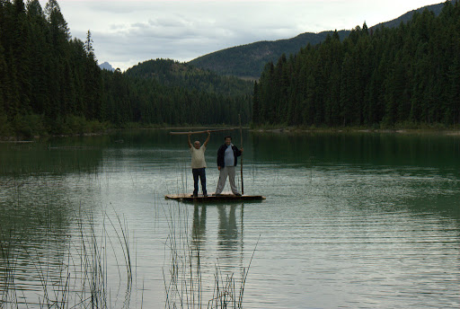
...and also managed to use some trick photography to show how they reached relativistic speeds. No photoshop used, I swear.
This concludes part 1 of Canadventure.
Technorati Tags: Canada, Rockies, Canadian Rockies, Jeep, Banff, Kootenay, Travel Blogs, Eran Davidov